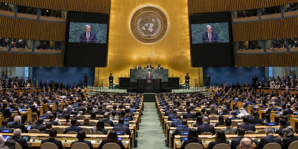
The United Nations spent Friday arguing about a map. Not about mines in the Strait of Hormuz. Not about failed states, famine, or the next round of empty peacekeeping resolutions. A map.
On September 4, the General Assembly adopted a Togo-sponsored text called “Correct the Map,” backing the 2018 Equal Earth projection over the familiar Mercator chart that sailors have used since 1569. The tally was 164 in favor, one against, and six abstentions. The lone no vote belonged to the United States. Estonia, Georgia, Lithuania, Moldova, Serbia, and Ukraine sat it out.
Washington did not pretend this was a civics lesson about Greenland. Deputy U.S. representative to ECOSOC Yaryna Ferencevych said the resolution was dressed up as “an anodyne effort to update cartographic proportions” and was, in fact, part of “a much larger and more radical ideological project.”
Instead of focusing on genuine problems of international peace, prosperity, or good relations, this body is debating map projects from the 16th century and their role in promoting reparations and cognitive justice.
Then the line that should be carved over the visitors’ entrance on First Avenue. “Resolutions like this one and the ideological agenda they promote are barnacles on our work here and the reason this institution is losing its credibility.”
Africa Is Large. That Is Not the Fight.
Africa is enormous. Anyone who has stood in front of a globe already knew it. On a Mercator wall map, Greenland can look like a peer of the continent. In real acreage, Africa is about fourteen times larger. That distortion is not a secret cabal. Gerardus Mercator built the 1569 projection so a compass course would plot as a straight line.
Cartographers have been complaining about the stretch near the poles for a century. Google revived a Web Mercator variant in 2005 because it pans and zooms without tearing the screen in half. Utility, not theology.
Equal Earth, drawn in 2018 by Bojan Šavrič, Bernhard Jenny, and Tom Patterson, keeps land area closer to true scale and still looks like a world map instead of a peeled orange. Fine. Print it. Hang it in a classroom. Nobody in America is required to pretend Greenland is the size of Algeria.
The resolution does not ban Mercator. It does something slipperier. It plants the United Nations’ official blessing on equal-area maps as the preferred picture of the planet and invites governments, schools, agencies, and tech firms to fall in line. France, according to reporting carried by Breitbart, announced it would abandon Mercator the same day. That is how a “nonbinding” vote becomes tomorrow’s textbook.
Cognitive Justice Is Not Cartography
Read the text, not the press release. The resolution treats old map distortions as “historical biases” with cognitive, educational, cultural, geopolitical, and socioeconomic effects. Correcting them, it says, will promote recognition, justice, and development, “particularly with regard to the African continent.”
Campaign language and allied statements call the whole project an act of “cognitive justice” and “memorial reparation.”
That is the tell. The earth did not shrink Africa. A Flemish mapmaker optimized a chart for ships. Turning that fact into a morality play about colonial vision is how you smuggle reparations talk into a cartography vote. Togo Foreign Minister Robert Dussey, introducing the measure for the African Group, offered the soft version.
A fair map does not change the geography of the world; it changes how we see the world. And when our perspective becomes more just, it paves the way for greater understanding, respect and peace among nations.
Peace from a projection. If only it worked that way in Sudan, the Sahel, or the Horn. The same week African and Caribbean leaders have been pressing for payments, debt cancellation, and formal apologies over slavery, the General Assembly decided the urgent work of nations was which silhouette children should memorize. The map is the sermon. The collection plate comes later.
And hath made of one blood all nations of men for to dwell on all the face of the earth, and hath determined the times before appointed, and the bounds of their habitation.
God set the bounds. A committee in Turtle Bay does not unsay them by preferring one equal-area formula over another. Size on paper never made a people free, honest, or prosperous. Bad government, tribal war, corruption, and the cult of grievance have done more to shrink Africa’s future than Gerardus Mercator ever did.
The Lonely Vote Was the Honest One
India voted yes and still felt the need to say the resolution should be read as support for equal-area maps in general, not a canonization of Equal Earth itself. Even the amen corner knows a single official picture of the world is a political instrument. The United States simply said the quiet part in public.
A body that cannot keep peace, cannot keep its books, and cannot keep member states from treating the Charter like optional reading now wants to supervise how the continents look on a poster.
That is not science class. That is the same instinct that turns every Western artifact into an indictment and every African statistic into someone else’s original sin.
Draw a better map if you want one. Teach children that the globe is not a rectangle. Then go back to work that matters. The earth is already the size God made it. No vote in New York will change that, and no new projection will pay a ransom for the past.